Monthly Archives: March 2012
Busiest and best day for my blog!!
Today I published two post
2 Never Give up – Everything is mind.
and here comes the stats for busiest day for my blog!! Its small but want to share it with all
“A journey of a thousand miles begins with one small step”
Never Give Up – Everything is Mind
When I was doing my Basic Mountaineering Course in HMI Darjelling there was one instructor Mr. Bhutia. We used to call him Bhutia Sir – extremely talented and a very good teacher. Whenever he used to teach us he used to repeat these words !!
- Everything is Mind – u know Everything is Mind
- If you can do it here in this part of Himalayas you will run in others
This pic which I came across (most famous pic on twitter for this week) while reading something on net reminds of everything what Norbu Sir said!!
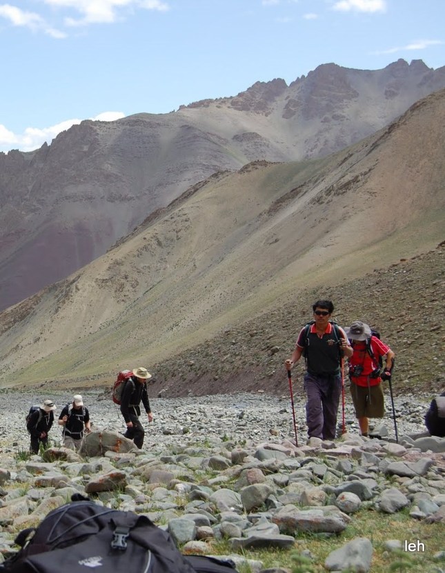
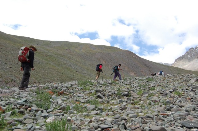
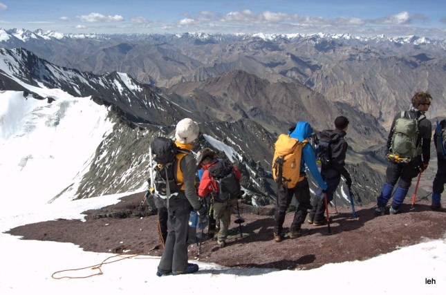
This is one example which proves that everything is mind!! The other example when I went for Stok Kangri Expedition in Leh Ladakh, India. This gentleman in the pic inspired me a lot..he was with us during the trek and also on the summit of Stok Kangri (6153 Metres).
While trekking we were sitting and their group crossed us!!
And On the Summit of Stok Kangri Trek !! He is there with us!!
Obstacles or blocks or excuse are nothing but creation of our mind !! I think
If they can , We can and You can do
Switzerland of Uttarakhand Chopta or Trek Deoriatal – Chopta – Tungnath – Chandrashila
Chopta is a picturesque hamlet which is still unexplored by travelers. Chopta is the commencement point of the trek to Tungnath – 3rd Kedar. Another 1.5 km trek from Tungnath leads to Chandrashila (4000mts above sea level) which offers a splendid view of snow clad Himalayan peaks including Nanda Devi, Trishul and Chaukhamba stretched widely. If some one want more can do a Deorital to Chadrashila trek which will we super delight for beginners.
Chopta itself offers splendid views of the imposing Himalayan range including Trishul, Nanda Devi and Chaukhamba. It is located at an elevation of 2680mts above sea level. Chopta is rich in varied flora and fauna. Chopta is situated amidst thick forest of pine, deodar and rhododendrons.
To reach Chopta take a train Ndls Ddn Ac Exp (12205) from Delhi to Haridwar and from Haridwar take a shared taxi, hire cab or take a bus to Ukhimath. These bus taxi take around 8 to 10 hours to reach Ukhimath and from Ukhimath Chopta is is easily accessible and 37KMs. It is located on the road connecting Gopeshwar with Guptkashi. Wake up with cool salubrious breeze and chirping of birds in Chopta. The morning view from Chopta is invigorating when the crimson rays of sun kisses the snow laden Himalayas. Carry light woolens in summers and heavy woolens in winters while planning a visit to Chopta. Hotel in Chopta provides standard accommodation facilities at affordable prices.
Chopta, Tungnath and Chandrashila are covered with snow during winters. If you visit the place during Dec-Feb, you may witness snowfall and enjoy trekking in snow.
Socialvibe badge on my to support the Environment
WordPress is having the SocialVibe widget and I have just started using it on my blog, by doing so I will be helping Social Vibe to earn donations for the charity for environment causes which will donated to WWF and other agencies.
Each time someone visits my blog and engages with my post and pictures I am making a little difference. This will be visible on my blog as well.
I request to click the badge and help me in saving our environment.
Regards
Trans Himalayan Jeep Expedition – Manali to Leh
About Ladakh
Check out Photos here >>>>>>>>>>>>>> and don’t forget clike the LIKE button!!
Ladakh a barren, virtually rainless area is the most remote region of India. The defiance of its barren landscape, unique flora and fauna, birds, culture, clear blue skies and clean air has much more to offer than just a good holiday. Ladakh is also known as “The Moonland” and romantically as “the last Shangri La” where as Ladakh in Tibetan language means “The Land of Passes”

Ladakh is surrounded by world’s biggest mountain ranges, the Himalayan range and the Karakoram. These lay crossways two others Zanskar and Ladakh range. The main watercourse of Ladakh is Indus which penetrates India from Tibet at Demchok. The highest altitude you will find here is 7637 m. At this height, the air is thin and the heat of the sun is intensely felt. That is why it is said Ladakh is the only place on earth where you can get sunburn as well as frostbite at the same time.
Ladakh has a distinct alpine, floral and faunal variety. Several flowering plants, a dozen important mammals and over a hundred species of birds are found here in this rugged terrain. You are likely to spot marmots, mouse hares, stone martens, red foxes, wolves, ibex, bharal, chiru (Tibetan antelope famous for Shahtoosh), goa (Tibetan gazelle), lynx, pallas cat, kyamg and shapu.
The avid bird watcher can spend fruitful hours by observing Bactrian magpies, grey tits, chough, raven, sparrow, kite, kestrel, Turkoman rock pigeon, chukor, finches, buntings, larks, desert wheat eaters, a many more varieties of birds. Black necked crane, bar-headed geese, ducks and several other water birds breed near the lakes in thousands. The highest realm belongs to the birds of prey and carrion eaters. These include choughs, griffon vultures, ravens and lammergeiers (bearded vultures).
During the safari we cross through two famous high altitude passes i.e. Baralacha and Tag Lang La, which is also the second highest motorable road in the world. Crossing through various tiny villages and monasteries we stop at a few and explore. We visit the famous Tsokar lake which is also known as the “White Lake” because of the salt deposited around it. The local nomads collect this salt and sell it in Ladakh and Kashmir.
Nubra Valley
Nubra Valley is about 150 km north of Leh, the capital town of Ladakh, India. Local scholars say that its original name was Ldumra (the valley of flowers). The Shyok River meets the Nubra or Siachan River to form a large valley that separates the Ladakh and the Karakoram Ranges. The average altitude of the valley is about 10,000 ft. above the sea level. The common way to access this valley is to travel over the Khardung La from Leh. Non-locals require an Inner Line Permit (obtainable in Leh town) to enter Nubra.
Pangong Tso:
Pangong Tso: is an endorheic lake in the Himalayas situated at a height of about 4,350 m (14,270 ft). It is 134 km (83 mi) long and extends from India to Tibet. 60% of the length of the lake lies in Tibet.
The brackish water of the lake has very low micro-vegetation. Guides report that there are no fish or other aquatic life in the lake, except for some small crustaceans. On the other hand, visitors see numerous ducks and gulls over and on the lake surface. There are some species of scrub and perennial herbs that grow in the marshes around the lake.
The lake acts as an important breeding ground for a variety of birds including a number of migratory birds. During summer, the Bar-headed goose and Brahmini ducks are commonly seen here. The region around the lake supports a number of species of wildlife including the kiang and the Marmot.
Day 01: Manali to Sarchu
Today we start our journey to Leh stopping at Sarchu for a night. We cross Rohtang Pass (3978 m), Keylong (3350 m), Baralacha Pass (4890m) with overnight stopover at Sarchu (4253 m), border of the states of Himachal Pradesh (Lahaul) and Jammu & Kashmir (Ladakh). Photography workshop “Stop Shooting Auto” on basics of photography and how to do photography in high altitude areas. Upon arrival in Sarchu we will set up our camp for overnight stay.
Day 02: Sarchu to Leh
Leave for Leh by early morning, through Nakeela and Lachangla Pass 16,617 ft. Lunch at Pang. After Lunch drive to Leh passing through Skyangchu Thang (Biggest and Highest Plateau on Earth on Stretch of 42 Kms), Tanglang La Pass 17,585ft and Indus Valley. Upon arrival in leh you will be greeted by our CEOs (chief Experience Officers) meet our representative and check in at our Hotel.
Day 03: Leh to Pangong Lake
After an early breakfast we leave for Pangong Lake through Changla pass 5486 Mtrs. Pangong Lake, situated at 14,000 feet (4,267 m). A long narrow basin of inland drainage, hardly six to seven kilometer at its widest point and over 130km long, it is bisected by the international border between India and China. Enjoy the landscape in the back drop of the Lake. Evening at leisure and overnight stay on the shore of Lake.
Day 04: Pangong Lake to Leh
Morning at leisure to explore the beauty of lake and later we drive back to leh enroute visiting Hemis Gompa, the largest monastic foundation of Drukpa Kagyu Order of Tibetan Buddhism, Thiksey an impressive complex rising tier upon tier on a hill above the village, Shey Palace, The ancient capital of Ladakh & Stok Palace Museum. Drive further to Leh and check in at our hotel for Overnight
Day 05: Drive to Nubra Valley
After an early breakfast we drive to Nubra Valley leads through Khardungla- Pass (the highest motorable road in the world) at 18,390 ft, around 39kms from Leh. Nubra Valley is popularly known as Ldorma or the valley of flowers. It is situated to the North of Ladakh between the Karakoram and Ladakh ranges of the Himalayas. Arrive Sumur or Hunder by afternoon and rest of the day at leisure to explore beautiful village of Sumur & Hunder with a Visit to Diskit Monastery. Overnight stay at Camp.
Day 06: Nubra Valley – Leh
After your breakfast at the camp, visit the Sand Dunes to enjoy a camel safari. Later we drive to Leh over Khardung La. Afternoon rest and relax or take a walk to the local market. Overnight at hotel.
Day 07: Leh
Post breakfast we drive towards Kargil road and start our sightseeing with Hall of Fame near Leh is worth a visit for every citizen. It is a glorious museum constructed by Indian army, Kali Mata Temple, Gurudwara Patthar Sahib Nestled deep in the Himalayas, which was built by the Lamas of Leh in 1517 to commemorate the visit of Guru Nanak Dev. A drive of another 4 km took us to Magnetic Hill which defies the law of gravity. It has been noticed that when a vehicle is parked on neutral gear on this metallic road the vehicle slides up & further Driving through a picturesque landscape we reached the confluence of the Indus and Zanskar River 4 km before Nimmu village. And Visit to Basgo a certainly the most impressive of Ladakhi citadels despite its ruined state. After visiting above places we drive back to Hotel for Overnight Stay.
Day 8: Leh Depart Leh
Transfer to domestic airport to catch the flight for your onward destination, safari concludes.
Dates: 2nd June 2012 to 9th June 2012
Cost: INR 14,500 inclusive of taxes, no hidden charges, price is for Manali to Leh includes all breakfast, lunch and dinner.It does not include any sort of tips, personal drinks etc
Book your adventure by paying 70% amount in advance, remaining to be paid once you reach Manali. If for some reason you wish to cancel your trek before 30days full amount will be refunded no refunds after that.
Contact Us
Jai Govind Meena
Mobile : 7597921601 Email : jaigovindmeena@gmail.com
Kapil Agarwal
Mobile : 9460634400 Email : vaish.kapil@gmail.com
http://www.renokadventures.com
My first post!!
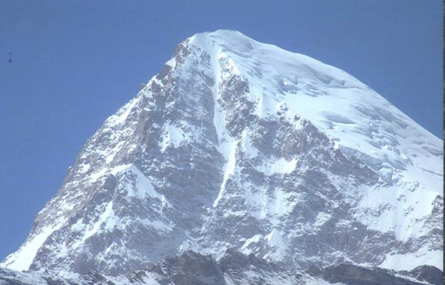
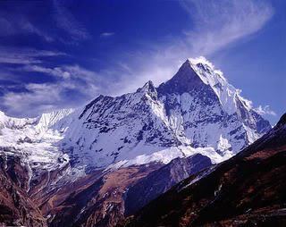
As a first post to start things rolling …posting few pictures shot during last one year in various parts of India e.g. Ladhakh, Uttarakhand, Sikkim, Rajasthan etc….
I saw these colorful mini sweet peppers at the store the other day and I wanted to photograph them but I had to come up with some sort of recipe so that Yes! Chef! would make them for me and then I could photograph them. Lo and behold there was a perfectly great recipe right on the back of the bag. I brought them home and waved them in front of Yes! Chef! He said something like, “Yes, they are pretty”. He knows my propensity for Crow Photography (photographing any pretty, shiny or colorful thing that I see), so he wasn’t culinarily very interested. Then I showed him the recipe on the back of the bag and I said things like, “Mmmmm. This looks great” and “I sure do love capers, olives and peppers” and finally, “Could you please make this for me and we could put it on steaks…
View original post 127 more words
Top 5 Mountain of Indian Himalayas
Top 5 Mountain of Indian Himalayas
The arc-shaped Himalayas extend along the entire northern boundary of India from the state of Jammu & Kashmir in west to Arunachal Pradesh in east. The term “Himalaya” from Sanskrit meaning the “The Abode of Snow”. For centuries Indians have been fascinated by these mountains for pilgrimage in early days now for trekking and other adventure sports (fast picking up in India).
The Indian Himalayas cover a vast area along the northern frontiers of the country and span five Indian States — Jammu and Kashmir , Himachal Pradesh, Uttar Pradesh, Sikkim and Arunachal Pradesh — from west to east. The true divisions of the Indian Himalayas are based on the mountain ranges rather than the state boundaries. From west to east, the Indian Himalayas can be divided into
- Kashmir (Jammu & Kashmir)
- Ladakh (Jammu & Kashmir)
- Zanskar (Jammu & Kashmir)
- Lahaul and Spiti (HP)
- Chamba (HP)
- Kinnaur (HP)
- Kumaon (Uttarakhand)
- Garhwal (Uttarakhand)
- Sikkim (Sikkim)
- Arunachal (Arunachal Pradesh)
Top 5 Mountain of Indian Himalayas
Khangchendzonga / Kanchenjunga
Kanchenjunga gets its name from the the Bhutia and Tibetan languages which means “The Five Treasures of Snows” as it contains five peaks. Kanchenjunga is the third highest peak in the world and 1st in India. Kanchenjunga stands tall with an elevation of 8,586 meters (28,169 ft). Goechala Trek and Dzongri Trek are famous trek from where one can have majestic views of this mighty mountain.

Kanchenjunga India
Nanda Devi (25663 ft, 7824 m)
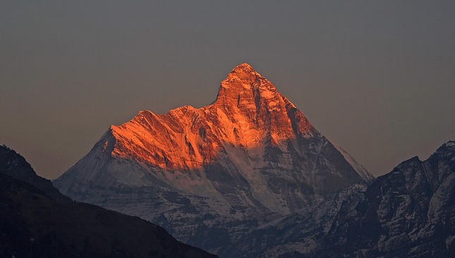
Nanda devi is the second highest mountain peak in India. This is the highest peak (entirely) in the country, as Kanchenjunga lies on the border areas of India and Nepal. It was the highest known mountain in the world until 1808 when western surveyors discovered Dhaulagiri. The mountain stands tall at an elevation of 7824 meters (25663 ft). The Nanda devi peak is the part of Garhwal Himalayas and lies in the state of Uttrakhand. Nanda Devi Biosphere Reserve is home to many famous treks like Roopkund Trek, Kuari Pass Trek, Valley of Flowers Trek, Har etc
Climbing is not allowed on Nanda Devi as it is declared as holy peak. During my discussion with Mr. Kushang Sherpa (Climbed Everest from all side including Kangshung face and other 8 thousanders) he said that Nanda Devi is the toughest to climb.
Kamet (25446 ft, 7756 m)
Kamet is the second highest mountain peak in Garhwal Himalayas. It lies in the Chamboli District of Uttrakhand. It is the third highest peak in India (according to India however, the rank is much lower as it includes in its list of mountains all those in Pakistan occupied Kashmir).
Saser Kangri (25172 ft, 7672 m)
Saser Kangri (or Sasir Kangri) is the highest peak in the Saser Muztagh, the easternmost sub-range of the Karakoram range in India. This massif lies toward the northwestern end of the Saser Muztagh, at the head of the North Shukpa Kunchang Glacier, a major glacier which drains the eastern slopes of the group.
Mana (23860 ft, 7273 m)
Northeast of Badrinath is another impressive cluster of mountain peaks. The mountains rise almost on the Indo-Tibetan border with Mana and Kamet as the principal peaks. Mana itself marks the eastern extremity of the Zanskar range. It lies between the pass of the same name and the Niti Pass.


